Next day was an important one with Agumbe in the list. The first destination was Kudlu Theertha waterfall which allegedly lies on Udupi-Hebri-Agumbe route. It’s not even known to locals and there is no direct bus to Kudlu Theertha from Agumbe. However we boarded a bus with a promise of getting us down as closer as possible to the falls and the distance was revealed once we got down at the last bus stop. Kudlu Theertha waterfall is some 10 km far from this village and there is no public transport on this route. Initially we gathered courage starting the trek but after walking 2-3 km, we inquired further and realized that we will have to walk more than 25 km to complete this. The trek was a worn-out concrete road amidst a dense forest I think. I offended Vishnu when I called it off. We returned back to the bus stop to catch the bus back to Hebri but it turned out an infinite wait.
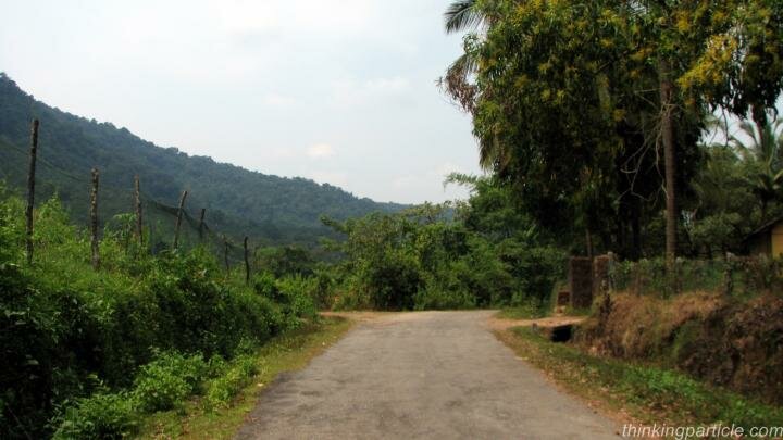
Road to Kudlu Thirtha Waterfalls
We walked…we roamed…we ran…we slept but Bus never came and there was just none to enquire about it. I think it is indisputably the least visited bus stop of the country. I admit that we both fell in for the bus stop and Vishnu started figuring out the possible stay option. Like spiritualism, the place has the magnate of grasping people in its realm detaching them completely from the outer objects and distractions. When patience exploded, we started walking towards the main road connecting Agumbe and there was no luck in hitch-hiking. We had to walk 5 km all the way till the main highway.
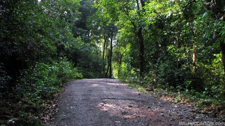
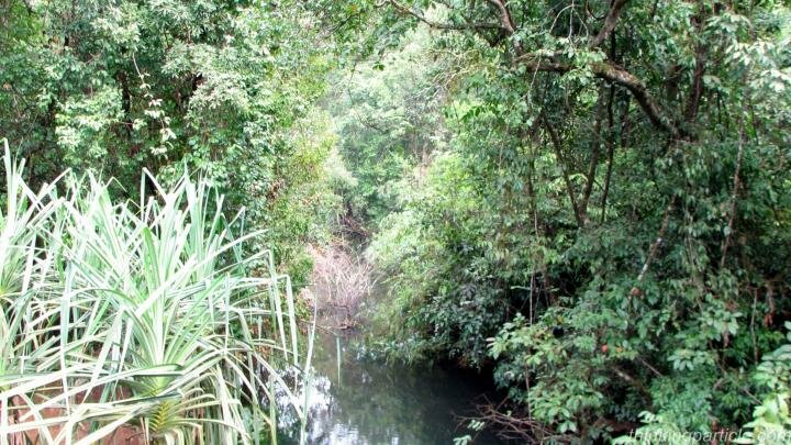
Lush Green forest on the way to Kudlu Theertha waterfalls
Kudlu Theertha Location: Kudlu Theertha waterfall is not on the way from Hebri to Agumbe. I think the route outlined below would be a help. It’s difficult to visit there if you are completely relying on public transport.
Udupi – Hebri – 2km – Right turn to Kudlu Theertha – 2 km – Someshwar – Agumbe
|
5 km
|
Last bus stop [Kudlu Theertha is some 10 km from here]
Finally we reached to main Hebri-Agumbe road and cool off our frustration with coconut water. I was already exhausted without even sighting any attraction. Soon after we caught a bus to Agumbe which was jam packed and plied through 18 hairpin bends while crossing Western Ghats. Traveling in a standing position and that too on this hilly route made things worse for me. Finally we reached Agumbe, a village about which I heard a lot from my dear friend and fellow traveler. Since my first glimpse of the Village, I was trying to understand why Vishnu boosted so much about this village devoid of life and indeed deprived of basic facilities. Rich biodiversity of the surroundings and intermittent rain were the conspicuous aspects for me but later Vishnu included few more to give me brief about Agumbe.

The Crossroad at Agumbe Village
These are some amazing facts about Agumbe those stand it apart as a distinguished destination.
From Vishnu Kumar:
- Agumbe was featured in famous TV serial “Malgudi Days”.
- Agumbe witnesses the second highest rainfall in the country hence also one of the last undisturbed tracts of montane rainforest and
moist evergreen forest of sub-continent.
- Agumbe got the highest density of King Cobras hence also known as “Capital of King Cobras” and the first King Cobra sanctuary of
the country was founded here only.
- Agumbe rain forest station is the only rain forest research center of the country which primarily studies on King Cobra and its habitat.
- There are also some other projects studying on flying lizards, frog species, rain forest’s plant species etc.
- If it’s a clear cloudless day, you can actually see Arabian sea from Agumbe
From Mohit Jain:
- Agumbe is connected with other towns with private busses only. There are frequent private busses
to/from Sringeri, Thirthahalli, Udupi.
- There are 3 Autos in Agumbe [Don’t laugh, I have counted and recounted and scored 99.6 percentile in
quantitative section of CAT].
- There is one lodge near bus stand [400 INR per night]
- Only BSNL Signals work at Agumbe.
- Sign boards are erratic and all are in Kannada.
- There is just one bus to/from Bangalore in a day.
- Only one restaurant that is at the bus stand.
- Beautiful Researchers at ARRS (Agumbe Rain forest research station :)
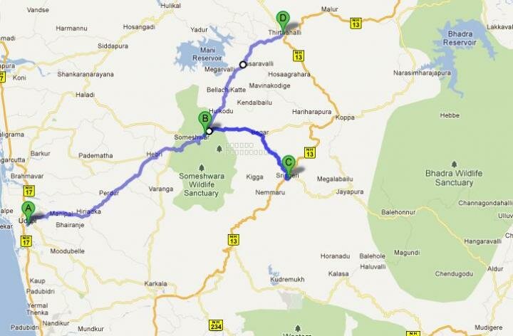
A= Udupi, B= Agumbe, C= Sringeri, D= Thirthahalli
Agumbe lies on a T point and the map above clarify it in a better way
Mysterious Kunchikal Falls
I was not interested to walk anymore so we both spent some time at the restaurant at Bus stand and later inquired about Kunchikal falls which is claim to be the highest water of India (Even Wiki says so) but none in the town was aware of that fall. I cannot understand/speak Kannada but I am paraphrasing the inputs those I received from the locals when I asked about this falls. [I interviewed more than 6 people about this fall]
“Someone has written incorrect information on internet. Many people come here and ask about Kunchikal falls but there is no Kunchikal falls. I think in deep forest there is a non-perennial water stream that only flows when it rains heavily and they started calling it waterfall but there is nothing like Kunchikal. We never heard this name. If anyone been there, why don’t they show us the photograph”
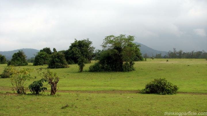
Landscape near Agumbe
Later I googled but never found a photograph of Kunchikal falls. There is always a controversy on highest waterfall of India but Kunchikal is certainly not one of the candidates. Kunchikal falls is just a myth and misleading to travelers. Information should be immediately removed. IF SOMEONE HAS BEEN TO KUNCHIKAL FALLS, PLEASE WRITE BACK WITH SUPPORTIVE EVIDENCE.
Agumbe Rainforest
Coming back to our story, there are some other waterfalls near Agumbe but all of those requires a bit of trekking which I wanted to avoid. Barkana Falls is some 10 km (On the way to Sringeri) and requires 2-3 km trekking in the forest. Onake Abbi falls is also on Sringeri but reaching till the bottom of the fall is complicated. Jogigundi is the nearest one to Agumbe but not worth a visit so finally we returned back to the restaurant at Bus stand and sipped another cup of tea. We were kind of settled and waiting for the evening to visit famous Sunset point ( On Clear day, from here you can actually see the Arabian sea) but suddenly Vishnu came up with an idea of leisurely walk till ARRS (Agumbe Rain Forest Research Station) which lies some 2-3 km away from Bus stand. ARRS is popular as Gowrishankar amongst the natives of Agumbe.
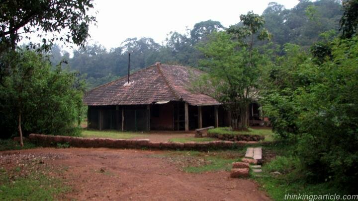
Agumbe Rain Forest Research Station
With some misleading inputs about the direction, we walked some 2-3 km towards Thirthahalli but there was no sign of ARRS. There was not even a village on the road side to inquire about. It was an impenetrable thick forest with water streams flowing underneath. Vishnu went inside a closed church but no help. Finally we stopped a mini-truck and inquired. He nodded and assumed as if we are going to Thirthahalli and asked us to hop in. Later He dropped us some 4-5 km far when I got to know about his assumption. “None wants to walk but life screws us all”… fortune was hidden somewhere in rain forest…even private busses were not stopping for us… disappointment, failure and fatigue surely infuriated me and I decided to find ARRS but anger alone does not always lead to success. We inquired back and forth and figured out the correct trail which was a mud road traversing through dense forest. After some 2 km on that trail, I realized it’s a wild goose chase and we both returned back to the bus stand.
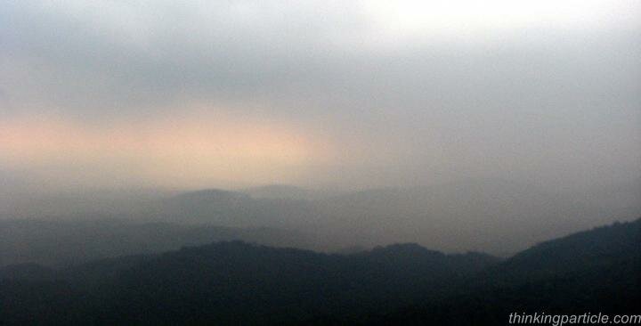
A Misty and noisy sunset at Agumbe
No matter Sun shines or not but there is always sunset just before the dusk and Agumbe is famous for one. In the evening, we hired an auto to sunset point which was a bit crowded or indeed more than a bit. Everyone passing by stopped there just to appreciate the clouds enveloping the hills. Vishnu quoted that He could see the other side of the clouds… ahead of sea waves… sun setting down the horizon and an exalted reflection … though it was nothing but memories receding into misty haze… We returned back to the bus stand and frowning curiosity led us to ARRS finally (This time by an Auto). There are some cottages for field researchers and volunteers. Vineet (botanist) provided an insight about the activities they are undertaking and ongoing projects. ARRS is worth a visit if you are anywhere near Agumbe. Soon intermittent drizzling transforms into heavy downpour and Agumbe withstood with its rank.
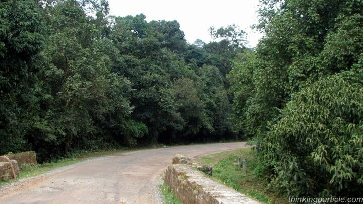
Road through Agumbe Rainforest
Important Distances from Agumbe:
Thirthahalli (31 km), Shimoga (93 km), Jog Falls (141 km),Mangalore (103 km), Udupi (55 km), Dharmasthala (117 km), Sringeri (25km)
Very Nice post. I was
Very Nice post. I was planning to explore agumbe. After seeing information in wiki, i too was interested in kunchikal falls etc. You have given extremely helpful hints/information otherwise it would have led me to unnecessary toil.
Welcome to Thinking
Welcome to Thinking particle... I am glad that information was helpful to other fellow travelers.. look forward to see you more often... have an awesome trip
Vishnu
About a month ago, i went on
About a month ago, i went on a trip to shimoga, exploring places just heard of, like you. We travelled almost all around the district in search of the Kunchikal falls, which internet claims to be the highest in India. We enquired all htrough the route about the falls, at Bhatkal, Jog falls, Sagar, shimoga, thirthahalli, Agumbe and all the way to Udupi. After the trip i was determined to find the secret of the falls, and enquired a lot, and finally last week met the chief forest officer at Agumbe.
There is indeed a waterfall by the name, about 20km deviation from Thirthahalli. But its a small one, and the 455m height, the internet claims about it, is its height above the sea level. He said lot of people had been spreading wrong info about it for the past 2 years. Jog falls is the highest waterfalls in India.
Hi Jim... Thanks for your
Hi Jim... Thanks for your valuable insight... i am glad that at least there is a waterfall by the same name.... for sure, it is not the highest waterfall of India... Internet is full of unreliable information...nevertheless Agumbe is certainly an awe-inspiring landscape...
Regards
Vishnu Kumar
Thanks Vivek for sharing such
Thanks Vivek for sharing such an insightful read about waterfalls in India... you seems like on an endless waterfalls spree... great to see passionate/crazy people like you around... Comprehensive and interesting read it was...
Kunchikal falls : it is near
Kunchikal falls : it is near Hosangadi, Kundapura Taluk, Udupi district,Karnataka or it is near Mastikatte, Hosanagara taluk (near Ghat temple) and it can be approached via tirtahalli, shimoga. About the height, it think it is a cascade of water, not a direct falls, and total height of this cascade may turn out to be what you found as "roumer". Varahi river falls over lot of rocks and I have seen it from distance. That was around 25 years ago. After Mani dam near Mastikatte,the water flow to this waterfalls is greatly reduced. Hope this information clarifies your doubt.
Thanks sir for sharing your
Thanks sir for sharing your experience with us... Now I started believing about the existence of Kunchikal falls.. I do agree with the reasoning about the impact through dam construction... You were lucky to sight it...Now its not visible at all...
Regarding height of
Regarding height of Kunchikal, that 'roumered' 455 mts may be true, when considering total cascading and step by step flow of Varahi river. This is the right time,(July-Aug) to explore and find out the height; better route to approach will be Shimoga > Hosangadi village > trek (from Hosangadi village, major portion of this falls (the cascading river, not direct drop) is visible. thank you.
Thanks sir... Will try my
Thanks sir... Will try my luck next time...
Nice, buddies, every year
Nice, buddies, every year twice i am visiting Agumbe only to sight the great creature " King Cobra" but till today i am not able to see it. But six month back when i visited near by village Kendalbyle during dawn hours while passing the bush along with my friend and the dog kariya, just heard big ' Hiss" sound and the dog ran like Usen Bolt, there was no light it was just 10 feet away from the bush. After returning home my friend father told that definetly it was " King" .
Agumbe its a great place i enjoyed lot during my visits.
Thanks for your comment
Thanks for your comment Suvarna... You are lucky to sight King Cobra in the wild... it is one of my dream and fear (I know it will scare the hell out of me).... I believe it's a beautiful creature.... Share some photographs of the King if you have taken those... Seems like you are an area expert of Western Ghats...
Cheers
Vishnu Kumar
Enjoyed going through ur
Enjoyed going through ur article, very lively and interesting. Was planning to walk along THirthahalli to Agumbe by bus route with a stop on th way for the night, any place to stay mid way.
I don't think there is any
I don't think there is any town between Agumbe and Thirthahalli where you can get accommodation... You should stay in Agumbe...Thirthahalli to Agumbe is also not a long distance...
This was a very informative
This was a very informative post. We were about start trip to kunchikal falls. Droping the plan... Thanks a lot
besides Kunchikal, there is a
besides Kunchikal, there is a lot around Agumbe... you must continue your plan...
Add new comment